- Difficulty Intermediate
- Time 5 hours
- Round-Trip 11km
- Elevation Gain 300 meters
- Season May - November
- Camping No
- From Vancouver 1 hour 40 minutes
- Public Transit No
- Dog Friendly Yes
Levette Lake is located in the Paradise Valley region just north of Squamish, BC. The hike takes you though mossy groves and up onto rocky outcrops with views of the Tantalus Range before returning through the Evans Lake Forest.
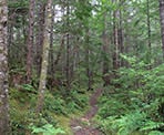
Next to the parking area, a rocky trail that looks like an old creek bed heads uphill and into the forest past a wooden sign with a map of the area. Continue up the trail where after 10 minutes you arrive at a junction. Go left and follow the Copperbrush Trail until you arrive at another junction a short time later. The path to the right is a short side trip to the Copperbrush Pond. After exploring the pond, walk back to the junction and go right to continue your trek through the moss and lichen covered forest.
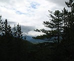
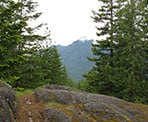
After a few minutes of forest, the trail begins to climb up the edge of rocks and onto an outcrop above. Follow the trail markers as the hike takes you up and over several small rocky outcrops, each offering occasional views of the Squamish Valley and Tantalus Range.
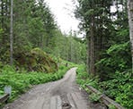
Eventually, the trail winds downhill and widens for a final stretch, crossing a small creek before arriving at a gravel forestry road. At the road go right and walk up the hill. Just after crossing a wooden bridge, note the trail on the left side that passes a rock and heads into the Evans Forest. When you return you will take this trail but for now, continue hiking up the gravel road towards Levette Lake. As the road begins to level, a junction appears on the left. Continue past this junction and the next one, staying on the main road until you reach a parking area and a large metal red gate. Just before the metal gate, a short trail ventures into the forest down a gradual hill and Levette Lake becomes visible between the trees. Walk off the trail towards the lake and find a nice spot to take in the views of the lake.
After enjoying a break at the lake, walk back towards the gravel road and retrace your steps along the forestry road heading back downhill. Just before arriving at the wooden bridge, enter the Evans Forest along a trail on the right side of the road. Walk along the rocky trail as it gradually heads uphill and eventually arrives at a dead-end. A narrower trail continues to the left and weaves through the Evans Forest taking you up onto rocky outcrops that again offer the occasional views of the Squamish River Valley and Tantalus Range.
The trail eventually heads downhill and arrives at an old set of wooden steps carved from a log. Carefully make your way down the slippery steps and continue walking downhill. The trail briefly levels in a valley where moisture helps the moss grow thick. Almost immediately, the trail again begins to climb to another rocky outcrop. Continue as the trail descends a final time to a wider trail known as the Fraser Burrard Trail.
A couple hundred meters after joining the wider trail, a wooden sign with a map of the area appears on the left of the trail near a junction. Taking the path on your right takes you to Evans Lake however, you cannot access the nearby forestry camp as it is private property. Take the route to the left, staying on the Fraser Burrard Trail, which will bring you back to the gravel forestry road. At the road, go right and walk for 15-20 minutes back downhill to where you parked earlier in the day.
How to get to Levette Lake Loop
Estimated Driving Time from Vancouver
1 hour 40 minutes
Levette Lake is located north of the town of Squamish in the Paradise Valley region. To reach the start of the trail, drive to Highway #1 (Trans Canada Highway) and head westbound towards Horseshoe Bay. Just before the ferry terminal, merge onto Highway #99 (Sea to Sky Highway) and drive north to Squamish.
Continue past Squamish and Brackendale and watch for signs for Alice Lake or Squamish Valley. At the intersection along the highway, turn left on the Squamish Valley Road and continue to a bridge. Immediately after the bridge, turn right onto the Paradise Valley Road and continue for about 2km to a gravel road on the left side of the road. This is the turnoff to Levette Lake and it is located across from the North Shore Outdoor School. Drive along the gravel road as it changes to a paved road and heads uphill. Be carefull of the large dips in the road as it is easy for cars to bottom out. The road becomes gravel again and a short distance after, you come across across a junction. Just off to the right is a small clearing at the side of the road. This is the parking area and the trail begins at the side of this area as a rocky path that heads uphill into the forest.
View a map of Driving directions to Levette Lake Loop.

Although we try to keep information as current as possible, www.vancouvertrails.com makes no warranty or representation as to the availability, quality, fitness for purpose, conditions or accuracy of the information provided with respect to this trail or trails. The information provided herein is further subject to our Terms of Use.


Comments
Add Comment View All Comments