- Difficulty Intermediate
- Time 5 hours
- Round-Trip 11km
- Elevation Gain 610 meters
- Season May - November
- Camping No
- From Vancouver 45 minutes
- Public Transit No
- Dog Friendly On-Leash
The Coquitlam Lake View Trail climbs up along the trails of Burke Mountain in Pinecone Burke Provincial Park to a rocky bluff with a spectacular view of the Coquitlam Watershed area. The route passes through a network of trails and deactivated logging roads before it climbs up a short steep trail just before the viewpoint.
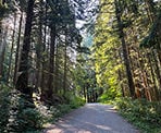
From the metal gate at Harper Road, walk up the gravel road and past the wooden map board. Follow the gravel road until it reaches another gravel road to the left. Go left on this gravel road and begin hiking uphill as it climbs at a fairly gently pace through the forest. You may notice several trails on both sides of the road that are used by mountain bikers.
When the road reaches the powerlines, continue walking up hill on the rocky section where a trail starts next to a wooden post. The trail marks the Coquitlam Lake View Trail and, on some posts or markers throughout the hike, maybe abbreviated to "CLVT". Walk up the narrow, rocky path and into the forest.
The trail immediately widens again and you follow an old, deactivated logging road for most of the hike. The trail is rocky, so pick your course as you make your way uphill. There are a few creek crossings that should be easily passable throughout the year when there is no snow. Continue to stay on the wide trail as you pass several junctions that veer off to the left or right.
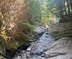
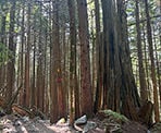
Eventually, the trail reaches a rocky creek with a small waterfall that tumbles down the rocks to the right. Carefully cross the rocky creek bed and veer left as you follow the wide trail. Just a short distance further and you reach a sign on the right pointing uphill to the "Coquitlam Lake View Trail". Go right and follow the narrow hiking trail as it climbs steep through the second generation growth forest. You will pass several huge stumps giving an indication how large some of the trees were before the area was logged.
The trail continues to climb until it reaches a junction with the South Ridge Trail. Go left and continue as you are back walking on a wide, old deactivated logging road again. This section of trail has very little elevation change as you pass through the area quite quickly.
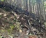
As you approach a junction, look for a sign on the right for a trail to the Coquitlam Lake Viewpoint. The old viewpoint used to be to the left and a short walk up, however the trees grew over the years and have blocked that view. The new viewpoint is to the right and a very steep, narrow trail to reach it. Follow the markers as you climb up the steep route and after five minutes or so, you will reach the rocky bluff with an incredible view.
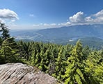
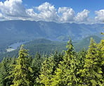
The view looks down onto the Coquitlam Watershed and across to the Eagle Mountain area. To the left, you can see a bit of Coquitlam and Port Moody in the distance.
After enjoying the view, carefully hike back down the steep trail, watching where you place your feet, as you return quickly to the old deactivated road. Go left and walk down the hill, following the same route you arrived. Go right at the junction and back down through the forest where the trail meets with the road again and the creek crossing near the small waterfall. Continue following the long trail back downhill, being mindful of the loose rocks, until you reach the powerlines. Then, walk straight downhill along the gravel road, making a right at the bottom and returning to the metal gate where you began your hike on Harper Road.
How to get to Coquitlam Lake View Trail
Estimated Driving Time from Vancouver
45 minutes
The Coquitlam Lake View Trail begins from the top of Harper Road in Coquitlam, BC. Parking is available along the side of the road. Make sure to check the parking signs and park in the designated areas.
If you're driving from Vancouver, make your way to Highway #1 and enter the highway heading eastbound. Before the Port Mann Bridge, get into the two right lanes on the highway and take Exit #44 BC-7B E ramp to Maple Ridge (the Mary Hill Bypass).
Continue along the Mary Hill Bypass and turn left at a set of lights onto Broadway Street. Go straight through another set of lights as the road crosses a large bridge over a railway yard called the Meridian Overpass. Continue driving straight on the other side of the overpass on what is now called Coast Meridian Road.
After driving for about 5km, including up a hill, use the right lane and turn right onto Harper Road. Drive to the 3-way stop and turn left. The road will turn into a gravel road as you continue a short distance where you will see a metal gated road on the right. Park on the left side in a designated parking area.
Note that if you reach the Port Coquitlam & District Hunting & Fishing Club, you went too far.
View a map of Driving directions to Coquitlam Lake View Trail.

Although we try to keep information as current as possible, www.vancouvertrails.com makes no warranty or representation as to the availability, quality, fitness for purpose, conditions or accuracy of the information provided with respect to this trail or trails. The information provided herein is further subject to our Terms of Use.

Comments
Add Comment View All Comments